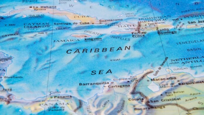
If you’re planning a trip to the Caribbean, or simply want to learn more about the region, studying a map of the Caribbean Islands can provide a wealth of information. Not only can it help you navigate the area and plan your itinerary, but it can also teach you about the region’s history, culture, and geography.
One of the first things you might notice when looking at a map of the Caribbean is the sheer number of islands in the region. There are over 7,000 islands, islets, and cays in the Caribbean, each with its own unique identity and history. Some of the most well-known islands include Jamaica, the Dominican Republic, Puerto Rico, and the Bahamas, but there are many others worth exploring as well.
In addition to the islands themselves, a map of the Caribbean can also teach you about the geography and climate of the region. The Caribbean Sea is bordered by Central America to the west, South America to the south, and the Greater Antilles and Lesser Antilles to the north and east, respectively. The area is known for its warm, tropical climate, which makes it a popular destination for tourists seeking sun, sand, and sea.
Geographic Overview of the Caribbean
The Caribbean is a region located in the Western Hemisphere, bounded by the Greater and Lesser Antilles, Central and South America, and the Atlantic Ocean. The region includes over 7,000 islands, islets, and cays, with a total land area of approximately 239,681 square kilometers. In this section, you will learn about the island groups and territories, as well as the physical geography and climate of the Caribbean.
Island Groups and Territories
The Caribbean is divided into several island groups and territories. The Greater Antilles include Cuba, Jamaica, Hispaniola (Haiti and the Dominican Republic), and Puerto Rico. The Lesser Antilles are divided into the Windward Islands and the Leeward Islands. The Windward Islands include Dominica, Martinique, Saint Lucia, Saint Vincent and the Grenadines, and Grenada. The Leeward Islands include the Virgin Islands, Anguilla, Saint Kitts and Nevis, Antigua and Barbuda, Montserrat, Guadeloupe, and Dominica.
Physical Geography and Climate
The Caribbean islands are located in the Caribbean Sea, which is bordered by the North and South American continents, the Atlantic Ocean, and the Gulf of Mexico. The islands are of volcanic origin, with some of the highest peaks in the region being found in the Greater Antilles. The climate of the Caribbean is tropical, with warm temperatures year-round and high humidity. The region is also prone to hurricanes and tropical storms during the Atlantic hurricane season, which runs from June to November.
In conclusion, the Caribbean is a diverse and beautiful region with a rich history and culture. By understanding the island groups and territories, as well as the physical geography and climate of the region, you can gain a deeper appreciation for this unique part of the world.


